

Listing ID#10009405
ModelGarmin Etrex Vista Mapping GPS (HCX)
CategoryTelecommunications
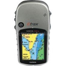
Garmin Etrex Vista Mapping GPS (HCX)
Specifications
- Origin
- Hong Kong
Quick answer
Garmin Etrex Vista Mapping GPS (HCX) is a Telecommunications product. Key specs — Origin: Hong Kong.
Product Description
Deep foliage, nor canyons phase the rugged eTrex Vista HCx. Its high-sensitivity receiver holds a GPS signal in the toughest environments. Similar to the Vista Cx, this handheld navigator also has a bright color screen, barometric altimeter, electronic compass, microSD card slot and automatic routing for wherever adventure takes you. With its high-sensitivity, WAAS-enabled GPS receiver, eTrex Vista HCx locates your position quickly and precisely and maintains its GPS location even in heavy cover and deep canyons. The advantage is clear - whether you're in deep woods or just near tall buildings and trees, you can count on Vista HCx to help you find your way when you need it the most. The Vista HCx has a built-in electronic compass that provides bearing information even while you're standing still, and its barometric altimeter tracks changes in pressure to pinpoint your precise altitude. You can even use the altimeter to plot barometric pressure over time, which can help you keep an eye on changing weather conditions. Adding maps is easier than ever with Vista HCx's microSD card slot. Conveniently plug in optional preloaded microSD cards with MapSource data for your land and sea excursions. Just insert a MapSource card with detailed street maps, and Vista HCx provides turn-by-turn directions to your destination. The card slot is located inside the waterproof battery compartment, so you don't have to worry about getting it wet. Like the rest of the eTrex series, Vista HCx is lightweight and compact - the perfect size for all your travels
| General | |
| Product Type | GPS receiver |
| Width | 2.2 in |
| Depth | 1.2 in |
| Height | 4.2 in |
| Weight | 5.5 oz |
| GPS System | |
| Recommended Use | Hiking |
| SBAS | WAAS |
| Connectivity | USB |
| GPS Functions / Services | Electronic compass, bearing, local pressure , altimeter |
| Antenna | Built-in |
| Features | Barometric altimeter, games |
| Supported Memory Cards | microSD |
| Software Included | MapSource Trip & Waypoint Manager, Garmin Atlantic Recreational Basemap |
| Compatible GPS Software | MapSource BlueChart |
| Navigation | |
| Waypoints | 1000 |
| Tracks | 20 |
| Tracklog Points | 10000 |
| Routes | 50 |
| Trip Computer | Sunrise/sunset times, sun/moon positions |
| Built-in Display | |
| Type | TFT |
| Resolution | 176 x 220 |
| Color Support | Color |
| Features | Anti-glare |
| Connections | |
| Connector Type | USB |
| Battery | |
| Form Factor | AA type |
| Required Qty | 2 |
| Run Time (Up To) | 25 hour(s) |
| Miscellaneous | |
| Design Features | Rugged case |
| Included Accessories | Wrist strap, USB cable |
| Waterproof | Yes |
| Waterproof Standard | IPX7 |
| Universal Product Identifiers | |
| Brand | Garmin |
Related Products
 Garmin nuvi 1200 Portable GPS Navigation System
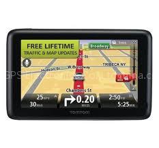 TomTom GO 2535TM World Traveler Edition Large-Screen Bluetooth GPS System w/ Transatlantic Maps, Lifetime Traffic & Maps Bundle
 Garmin Fishfinder 400C Compact Sonar System
 Garmin GPSMAP 541s Color GPS/Sonar Combo with Pre-Loaded Coastal Maps and Saltwater Transducer
 Garmin GPSMAP 526s Color GPS/Sonar Combo with Saltwater Transducer
 Garmin GPSMAP 546s Color GPS/Sonar Combo with Pre-Loaded Coastal Maps and Saltwater Transducer
 Garmin GPSMAP 720S Touchscreen GPS/Sonar Combo
 Lowrance Endura Sierra Touch-Screen Handheld GPS Receiver with Pre-Loaded Maps